


Heritage Experience
Path of the Brooms - from Linguaglossa
A window into the territory, through memory, light and landscape.
Story of the place
The story that remains
Linguaglossa is a town located approximately 520 meters above sea level, nestled in a valley that separates the slopes of Mount Etna from a mountain range that rises just above 800 meters, beyond which flows the Alcantara River. Historically, it has served as one of the main access points to the higher altitudes of the volcano, thanks to a paved road that ascends to 1,800 meters, allowing access to both alpine and Nordic ski slopes, as well as numerous nature trails, including those leading close to the summit craters.
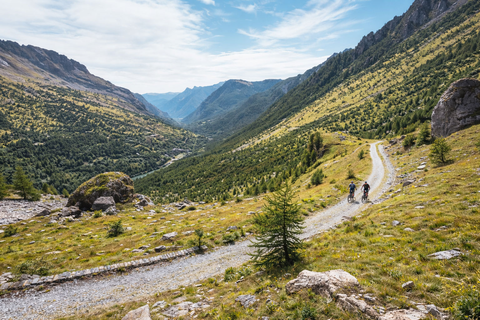
After passing the small locality of Catena, the route begins to gradually ascend, reaching the area of the Brunek and Ragabo Refuges, situated around 1,400 meters in elevation. From here, one enters a landscape of great scenic value, characterized by extensive pine forests and wide clearings within the Forest Reserve. The trail, generally lacking steep gradients, traverses areas such as Monte Crisimo and Serra Buffa, also passing by the craters formed during the 1928 eruption, which are worth a stop for their historical and natural significance. Nearby, one can also find the small Sanctuary of Magazzeni, built by the residents of Sant’Alfio as a token of gratitude for their safety during the same eruption.
Walking between 1,000 and 1,100 meters in altitude, one arrives at the Pietracannone Houses. From here, the path continues south with a short ascent that leads along the lower edge of the Valle del Bove, a vast lava amphitheater shaped by numerous flows, visible on the right side of the trail for over three kilometers. A slight detour of a few meters allows visitors to admire the Carrinu Holm Oak, a majestic tree estimated to be around 800 years old.
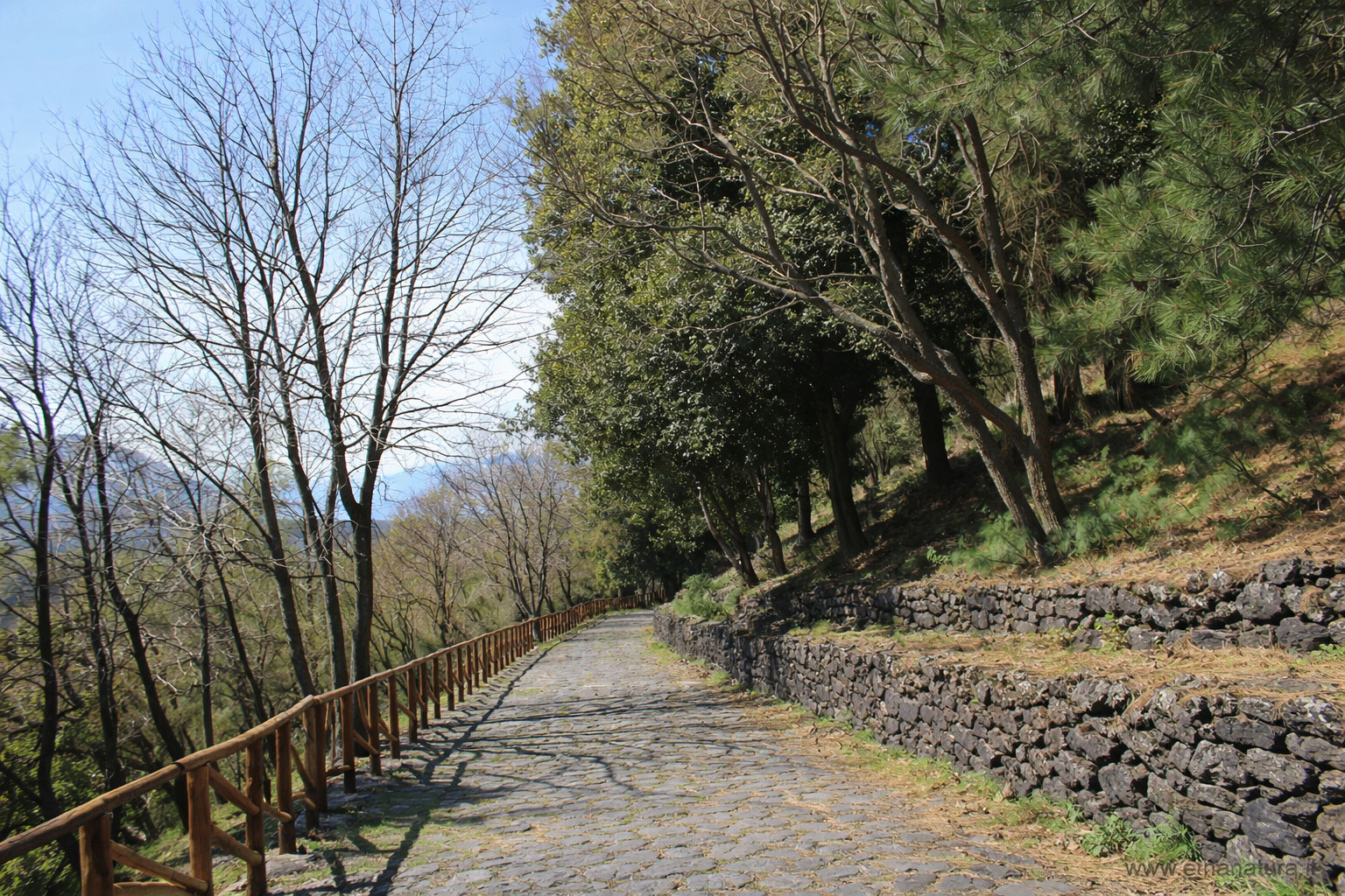
Continuing on, one reaches the locality of Ballo, on the outskirts of the urban area of Zafferana Etnea, which can serve as an ideal stop along the Ginestre Trail. Resuming the journey, the path remains below the forested area of the pine grove, entering a different environment from the mountainous terrain previously traversed: the agricultural Etna. Here, the landscape is marked by carefully cultivated and terraced fields, ancient rural buildings, and vineyards, which produce increasingly appreciated wines, ultimately leading to Nicolosi.
After passing the small locality of Catena, the route begins to gradually ascend, reaching the area of the Brunek and Ragabo Refuges, situated around 1,400 meters in elevation. From here, one enters a landscape of great scenic value, characterized by extensive pine forests and wide clearings within the Forest Reserve. The trail, generally lacking steep gradients, traverses areas such as Monte Crisimo and Serra Buffa, also passing by the craters formed during the 1928 eruption, which are worth a stop for their historical and natural significance. Nearby, one can also find the small Sanctuary of Magazzeni, built by the residents of Sant’Alfio as a token of gratitude for their safety during the same eruption.
Walking between 1,000 and 1,100 meters in altitude, one arrives at the Pietracannone Houses. From here, the path continues south with a short ascent that leads along the lower edge of the Valle del Bove, a vast lava amphitheater shaped by numerous flows, visible on the right side of the trail for over three kilometers. A slight detour of a few meters allows visitors to admire the Carrinu Holm Oak, a majestic tree estimated to be around 800 years old.
Continuing on, one reaches the locality of Ballo, on the outskirts of the urban area of Zafferana Etnea, which can serve as an ideal stop along the Ginestre Trail. Resuming the journey, the path remains below the forested area of the pine grove, entering a different environment from the mountainous terrain previously traversed: the agricultural Etna. Here, the landscape is marked by carefully cultivated and terraced fields, ancient rural buildings, and vineyards, which produce increasingly appreciated wines, ultimately leading to Nicolosi.
Rating
◆
For explorers
Heritage Experience
Visual memory
Details, perspectives and atmospheres that make the place felt.
Information
Where the story meets the territory
Not just a location: a point from which to read the landscape.
Cultural concierge
Expert Tip
Il sentiero delle Ginestre è lungo circa 12Km ha un dislivello di 650 m. si percorre in circa 6 ore.
Difficoltà media.
Ottimo per trekking Bici